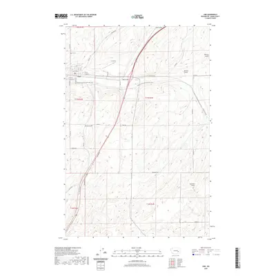
2020 Map of Lind
USGS Topo · Published 2020About this map
The town of Lind serves as the central hub of this Adams County landscape, situated where the high desert terrain is carved by distinctive drainage channels known as coulees. The map traces the passage of the Palouse To Cascades State Park Trail as it cuts through the territory, following a historic transportation corridor that passes just south of the town center. Local history is anchored by sites like the Lind Cem north of town and the Lind Airport, illustrating the community's infrastructure and long-standing presence in the region.
Find a feature on this map
38 named features on this map. Tap any name to fly to it.
Don’t see what you’re looking for? This feature index may not catch every label — zoom into the map to look around manually.
Map Details
Editions of this 2020 Lind Map
This is the sole edition of this map. No revisions or reprints were ever made.
Other maps of this area

1916 · Connell
USGS Topo · 1:125,000

1918 · Connell
USGS Topo · 1:125,000

1923 · Washtucna
USGS Topo · 1:62,500

1925 · Washtucna
USGS Topo · 1:62,500

1953 · Walla Walla
USGS Topo · 1:250,000

1953 · Ritzville
USGS Topo · 1:250,000

1958 · Walla Walla
USGS Topo · 1:250,000

1959 · Ritzville
USGS Topo · 1:250,000

1965 · Ritzville
USGS Topo · 1:250,000

1967 · Reiman SW
USGS Topo · 1:24,000