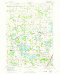
1969 Map of Linden
USGS Topo · Published 1971About this map
The Grand Trunk Western railroad corridor anchors the northern reach of this landscape, passing through the village of Linden, where it meets the winding Shiawassee River. This region on the border of Genesee and Livingston Counties is defined by an intricate network of glacial lakes and islands, including the sprawling Lobdell Lake with its Stage Island and Blue Gill Island. The settlement of Argentine sits at a narrow neck between water bodies, illustrating how early Michigan hamlets were shaped by the local hydrology and the necessity of water crossings.
Find a feature on this map
78 named features on this map. Tap any name to fly to it.
Don’t see what you’re looking for? This feature index may not catch every label — zoom into the map to look around manually.
Map Details
Editions of this 1969 Linden Map
3 editions found
Other maps of this area

1907 · Howell
USGS Topo · 1:62,500

1909 · Howell
USGS Topo · 1:62,500

1909 · Milford
USGS Topo · 1:62,500

1920 · Holly
USGS Topo · 1:62,500

1922 · Holly
USGS Topo · 1:62,500

1922 · Durand
USGS Topo · 1:62,500

1943 · Holly
USGS Topo · 1:62,500

1943 · Durand
USGS Topo · 1:62,500

1954 · Detroit
USGS Topo · 1:250,000

1961 · Detroit
USGS Topo · 1:250,000