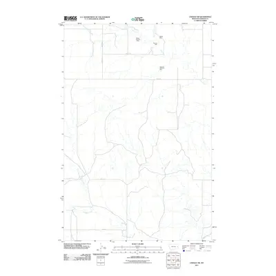
2011 Map of Lindsay SW
USGS Topo · Published 2011About this map
The northern Dawson County ranching landscape at the start of the 2010s is defined by a sophisticated system of water management. Small-scale earthen infrastructure like Walker Number 2 Dam, Fleming Dam, and the Walker Dam illustrate the essential role of water retention in this arid region, providing critical resources for livestock and land management. These structures are concentrated along the upper reaches of Clear Creek and its tributary, the South Fork Clear Creek.
Find a feature on this map
13 named features on this map. Tap any name to fly to it.
Don’t see what you’re looking for? This feature index may not catch every label — zoom into the map to look around manually.
Map Details
Editions of this 2011 Lindsay SW Map
This is the sole edition of this map. No revisions or reprints were ever made.
Other maps of this area

1953 · Miles City
USGS Topo · 1:250,000

1954 · Glendive
USGS Topo · 1:250,000

1957 · Miles City
USGS Topo · 1:250,000

1957 · Glendive
USGS Topo · 1:250,000

1958 · Miles City
USGS Topo · 1:250,000

1958 · Glendive
USGS Topo · 1:250,000
1967 · Fallon NE
USGS Topo · 1:24,000

1972 · Hendrickson Coulee
USGS Topo · 1:24,000

1972 · Diamond G Creek
USGS Topo · 1:24,000

1980 · Terry
USGS Topo · 1:100,000