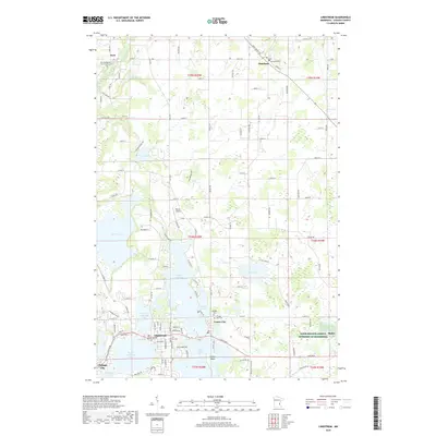
2019 Map of Lindstrom
USGS Topo · Published 2019About this map
The lake-strewn landscape of Chisago County is defined here by the interconnected waters of Chisago Lake, South Lindstrom Lake, and North Center Lake. These glacial basins dictate the layout of the primary settlements, with Lindstrom and Center City occupying narrow peninsulas and shores that separate the larger bodies of water. The topography is a complex arrangement of low-lying wetlands and subtle rises, which have historically influenced both the winding paths of roads like Saint Croix Trl and the location of several significant local burial grounds, including Almelund Cem and Fairview Cem. To the north, the Sunrise River meanders through more open terrain near Kost, where the Kost Evangelical Free Church Cem serves as a local landmark. The map also identifies the Barnes Airport and the Farm Service Agency Interest of Minnesota, reflecting the area's mix of aviation and agricultural administration.
Find a feature on this map
118 named features on this map. Tap any name to fly to it.
Don’t see what you’re looking for? This feature index may not catch every label — zoom into the map to look around manually.
Map Details
Editions of this 2019 Lindstrom Map
This is the sole edition of this map. No revisions or reprints were ever made.
Other maps of this area

1900 · St Croix Dalles
USGS Topo · 1:62,500

1901 · St Croix Dalles
USGS Topo · 1:62,500

1950 · Rush City
USGS Topo · 1:48,000

1951 · Milltown
USGS Topo · 1:48,000

1953 · Stillwater
USGS Topo · 1:250,000

1955 · St. Croix Dalles
USGS Topo · 1:62,500

1955 · Rush City
USGS Topo · 1:62,500

1955 · Milltown
USGS Topo · 1:62,500

1955 · Forest Lake
USGS Topo · 1:62,500

1955 · Stillwater
USGS Topo · 1:250,000