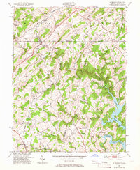
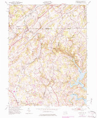
1953 Map of Lineboro
USGS Topo · Published 1966About this map
The Western Maryland railroad winds through the heart of this rural borderland, connecting several small agricultural and industrial hamlets along the Mason-Dixon line. Small communities like Lineboro and Alesia are defined by their proximity to the tracks and the nearby South Branch Gunpowder Falls. The landscape is dotted with numerous country churches and one-room schoolhouses, including St Johns Ch and Wolfgangs Sch, reflecting a deeply rooted local community structure.
Find a feature on this map
55 named features on this map. Tap any name to fly to it.
Don’t see what you’re looking for? This feature index may not catch every label — zoom into the map to look around manually.
Map Details
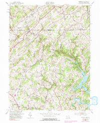
Editions of this 1953 Lineboro Map
6 editions found
Other maps of this area

1900 · Parkton
USGS Topo · 1:62,500

1902 · Parkton
USGS Topo · 1:62,500

1905 · Westminster
USGS Topo · 1:62,500

1908 · York
USGS Topo · 1:62,500

1910 · York
USGS Topo · 1:62,500

1920 · Hanover
USGS Topo · 1:62,500

1922 · Hanover
USGS Topo · 1:62,500

1944 · New Freedom
USGS Topo · 1:31,680

1944 · Manchester
USGS Topo · 1:31,680

1944 · Hampstead
USGS Topo · 1:31,680