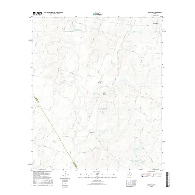
2016 Map of Lingleville
USGS Topo · Published 2016About this map
The Leon River basin defines this 2016 survey along the Erath Co and Comanche Co line. This landscape is shaped by the intensive water management of the Soil Conservation Service, which established numerous reservoirs including Soil Conservation Service Site 4 Reservoir and Soil Conservation Service Site 11 Reservoir to control runoff across the rolling agricultural plains. The small community of Lingleville sits in the northeast corner at the junction of FM 8 and FM 219, serving as a focal point alongside local landmarks like West End Cem. Further south, the settlement of Highland appears near the banks of Armstrong Cr. A complex network of farm roads, such as Co RD 355 and Co RD 354, connects these rural outposts with private aviation facilities like Quahadi Ranch Airport and remote burial grounds including Bethel Cem.
Find a feature on this map
54 named features on this map. Tap any name to fly to it.
Don’t see what you’re looking for? This feature index may not catch every label — zoom into the map to look around manually.
Map Details
Editions of this 2016 Lingleville Map
This is the sole edition of this map. No revisions or reprints were ever made.
Other maps of this area

1890 · Stephenville
USGS Topo · 1:125,000

1894 · Eastland
USGS Topo · 1:125,000

1920 · Stephenville
USGS Topo · 1:125,000

1954 · Abilene
USGS Topo · 1:250,000

1958 · Abilene
USGS Topo · 1:250,000

1965 · Huckabay SW
USGS Topo · 1:24,000

1965 · Lingleville
USGS Topo · 1:24,000
1965 · Dublin
USGS Topo · 1:24,000
1965 · Bunyan
USGS Topo · 1:24,000
1965 · Huckabay
USGS Topo · 1:24,000