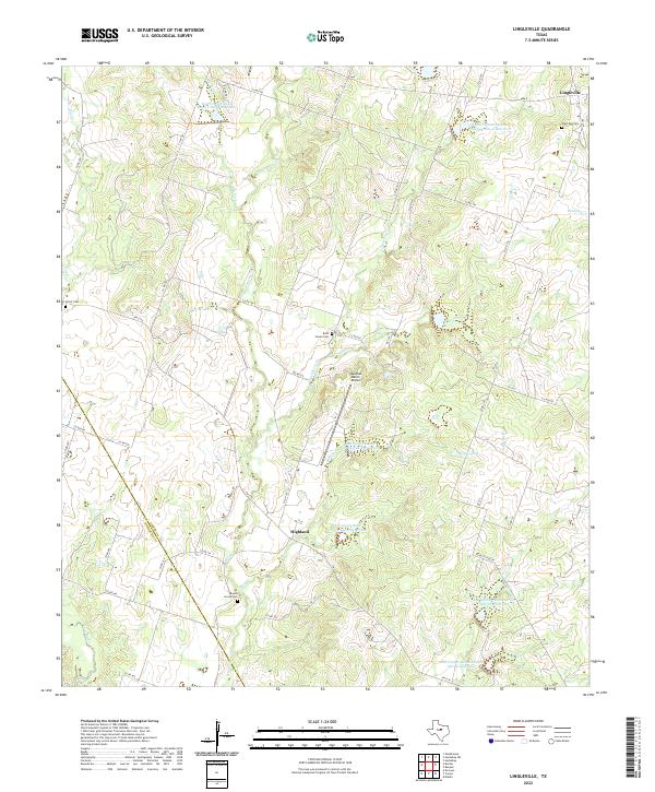
2022 Map of Lingleville
USGS Topo · Published 2022About this map
The community of Lingleville sits at the edge of the northwestern plateau in Erath County, marking a landscape defined by ranching and water management. Numerous reservoirs, including Soil Conservation Service Site 8 Reservoir and Soil Conservation Service Site 10 Reservoir, dot the terrain to manage the flow of the Leon River and its tributaries like Armstrong Cr and Henning Cr. This network of sites reflects the 20th-century focus on soil and water conservation in the Texas Cross Timbers region.
Find a feature on this map
55 named features on this map. Tap any name to fly to it.
Don’t see what you’re looking for? This feature index may not catch every label — zoom into the map to look around manually.
Map Details
Editions of this 2022 Lingleville Map
This is the sole edition of this map. No revisions or reprints were ever made.
Other maps of this area

1890 · Stephenville
USGS Topo · 1:125,000

1894 · Eastland
USGS Topo · 1:125,000

1920 · Stephenville
USGS Topo · 1:125,000

1954 · Abilene
USGS Topo · 1:250,000

1958 · Abilene
USGS Topo · 1:250,000

1965 · Huckabay SW
USGS Topo · 1:24,000

1965 · Lingleville
USGS Topo · 1:24,000
1965 · Dublin
USGS Topo · 1:24,000
1965 · Bunyan
USGS Topo · 1:24,000
1965 · Huckabay
USGS Topo · 1:24,000