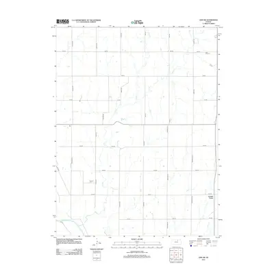
2012 Map of Linn SW
USGS Topo · Published 2012About this map
Garfield Center sits on the eastern edge of this agricultural landscape in Clay County, where the sprawling grid of section roads meets a network of vital waterways. The southern boundary is defined by the winding course of the Republican River, a primary drainage that has shaped the region's topography and land use. Throughout the central and northern reaches, smaller tributaries like Peats Cr and Spring Cr carve through the prairie, providing the primary relief in an otherwise strictly organized rural layout.
Find a feature on this map
27 named features on this map. Tap any name to fly to it.
Don’t see what you’re looking for? This feature index may not catch every label — zoom into the map to look around manually.
Map Details
Editions of this 2012 Linn SW Map
This is the sole edition of this map. No revisions or reprints were ever made.
Other maps of this area

1891 · Clay Center
USGS Topo · 1:125,000

1893 · Washington
USGS Topo · 1:125,000

1955 · Manhattan
USGS Topo · 1:250,000

1956 · Manhattan
USGS Topo · 1:250,000

1957 · Manhattan
USGS Topo · 1:250,000

1964 · Clay Center NW
USGS Topo · 1:24,000
1964 · Clay Center NE
USGS Topo · 1:24,000

1964 · Miltonvale NE
USGS Topo · 1:24,000

1965 · Clifton
USGS Topo · 1:24,000

1965 · Brantford
USGS Topo · 1:24,000