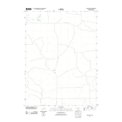
2011 Map of Linscott SW
USGS Topo · Published 2011About this map
The high plains of Nebraska in Custer County are defined here by a sparse network of section lines and gravel roads that follow the rise and fall of the Sandhills. Transport through this rural landscape relies on arteries like Arnold Dunning Rd and Dunning Rd, which cut across the open terrain to connect isolated ranchlands and seasonal water features. The presence of Mills Valley Rd in the southwestern portion of the map suggests a geographic orientation toward localized valley systems, common in this region where the surface drainage often disappears into the permeable sandy soil. This 2011 survey captures the area before modern digital updates significantly altered the visual representation of this remote section of the Nebraska interior.
Find a feature on this map
3 named features on this map. Tap any name to fly to it.
Don’t see what you’re looking for? This feature index may not catch every label — zoom into the map to look around manually.
Map Details
Editions of this 2011 Linscott SW Map
This is the sole edition of this map. No revisions or reprints were ever made.
Other maps of this area

1948 · Linscott
USGS Topo · 1:62,500

1950 · Linscott
USGS Topo · 1:62,500

1951 · Hoagland
USGS Topo · 1:62,500

1954 · North Platte
USGS Topo · 1:250,000

1956 · North Platte
USGS Topo · 1:250,000

1957 · North Platte
USGS Topo · 1:250,000

1967 · North Platte
USGS Topo · 1:250,000
1972 · Davenport Table
USGS Topo · 1:24,000

1972 · Logan
USGS Topo · 1:24,000

1972 · Arnold
USGS Topo · 1:24,000