
1972 Map of Logan
USGS Topo · Published 1975About this map
The South Loup River winds through the northeast corner of this Nebraska landscape, paralleled by the steel of the Union Pacific railroad. This 1970s survey captures the area as a network of rural homesteads and isolated landmarks, including the small settlement of Logan near the northern boundary and Beckwith to the south. The terrain is marked by the prominence of Kings Hill, while numerous wells across the quadrangle indicate the critical importance of water access for the local agricultural economy. In the southern reaches, Sand Creek cuts through the topography, passing near a Quarry and the Garfield Ch. The map also meticulously records political boundaries, showing where the borders of Logan, Custer, and Lincoln Counties converge.
Find a feature on this map
12 named features on this map. Tap any name to fly to it.
Don’t see what you’re looking for? This feature index may not catch every label — zoom into the map to look around manually.
Map Details
Editions of this 1972 Logan Map
This is the sole edition of this map. No revisions or reprints were ever made.
Other maps of this area

1948 · Linscott
USGS Topo · 1:62,500

1950 · Linscott
USGS Topo · 1:62,500

1951 · Hoagland
USGS Topo · 1:62,500

1954 · North Platte
USGS Topo · 1:250,000

1956 · North Platte
USGS Topo · 1:250,000

1957 · North Platte
USGS Topo · 1:250,000

1967 · North Platte
USGS Topo · 1:250,000

1972 · Arnold
USGS Topo · 1:24,000
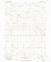
1972 · Gandy
USGS Topo · 1:24,000
1972 · Gandy SW
USGS Topo · 1:24,000