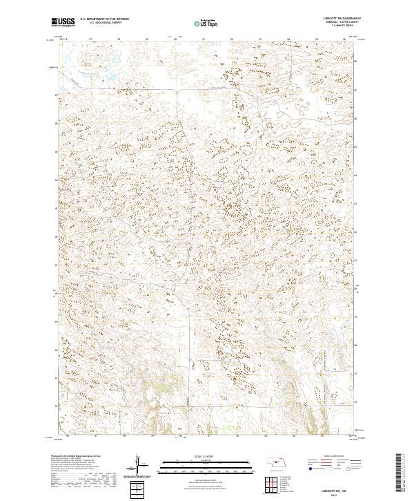
2021 Map of Linscott SW
USGS Topo · Published 2021About this map
Mills Valley and the higher elevations of western Custer County define the landscape of this 2021 survey. The terrain is structured by a network of rural routes, including Dunning Rd and the prominent Arnold Dunning Dr crossing the northern sections. This rural pocket of Nebraska exhibits the classic township and range grid of the Great Plains, here divided into t19n r25w, t19n r24w, t18n r25w, and t18n r24w. The geography is shaped by drainages such as those following Upper Powell Canyon Rd in the southeast and Mills Valley Rd in the southwest. Local travel and property access rely on these established corridors, including the border route Logan Co Rd and the southern Rd 806, which navigate the varying elevations and cattle-country topography characteristic of the region.
Find a feature on this map
10 named features on this map. Tap any name to fly to it.
Don’t see what you’re looking for? This feature index may not catch every label — zoom into the map to look around manually.
Map Details
Editions of this 2021 Linscott SW Map
This is the sole edition of this map. No revisions or reprints were ever made.
Other maps of this area

1948 · Linscott
USGS Topo · 1:62,500

1950 · Linscott
USGS Topo · 1:62,500

1951 · Hoagland
USGS Topo · 1:62,500

1954 · North Platte
USGS Topo · 1:250,000

1956 · North Platte
USGS Topo · 1:250,000

1957 · North Platte
USGS Topo · 1:250,000

1967 · North Platte
USGS Topo · 1:250,000
1972 · Davenport Table
USGS Topo · 1:24,000

1972 · Logan
USGS Topo · 1:24,000

1972 · Arnold
USGS Topo · 1:24,000