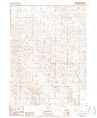
1986 Map of Linscott SW
USGS Topo · Published 1987About this map
Judkins Table rises as a prominent high-ground feature within this part of Custer County, dominating the southern landscape. This mid-1980s provisional survey illustrates the intricate drainage patterns and undulating topography characteristic of the Nebraska Sandhills region. The map reveals a land defined more by its natural relief than by dense infrastructure, showing a sparse network of section lines and isolated landmarks. One such functional marker is a Corral located in the southeastern portion of the sheet, providing a specific point of interest for researchers tracking agricultural land use or historical grazing practices. The survey was compiled from aerial photography taken in 1983, capturing the rural character of the area during a period of modern ranching and land management.
Find a feature on this map
4 named features on this map. Tap any name to fly to it.
Don’t see what you’re looking for? This feature index may not catch every label — zoom into the map to look around manually.
Map Details
Editions of this 1986 Linscott SW Map
This is the sole edition of this map. No revisions or reprints were ever made.
Other maps of this area

1948 · Linscott
USGS Topo · 1:62,500

1950 · Linscott
USGS Topo · 1:62,500

1951 · Hoagland
USGS Topo · 1:62,500

1954 · North Platte
USGS Topo · 1:250,000

1956 · North Platte
USGS Topo · 1:250,000

1957 · North Platte
USGS Topo · 1:250,000

1967 · North Platte
USGS Topo · 1:250,000
1972 · Davenport Table
USGS Topo · 1:24,000

1972 · Logan
USGS Topo · 1:24,000

1972 · Arnold
USGS Topo · 1:24,000