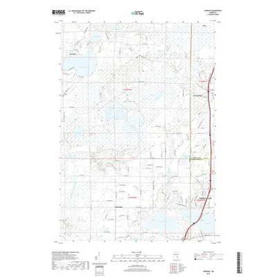
2019 Map of Linwood
USGS Topo · Published 2019About this map
The low-lying wetlands and glacial lakes of northern Anoka Co define this landscape, where the communities of Linwood, Wyoming, and Columbus sit amidst a complex network of water bodies and drainage ditches. Significant hydrographic features including Linwood Lake, Howard Lake, and Columbus Lake dominate the terrain, connected by systems like County Ditch Number Thirtyone and County Ditch Number Fortyfour. This drainage infrastructure highlights the historical effort to manage the high water table for agricultural and residential use.
Find a feature on this map
107 named features on this map. Tap any name to fly to it.
Don’t see what you’re looking for? This feature index may not catch every label — zoom into the map to look around manually.
Map Details
Editions of this 2019 Linwood Map
This is the sole edition of this map. No revisions or reprints were ever made.
Other maps of this area

1902 · White Bear
USGS Topo · 1:62,500

1948 · Stillwater
USGS Topo · 1:62,500

1949 · Stillwater
USGS Topo · 1:62,500

1952 · Centerville
USGS Topo · 1:24,000

1953 · Stillwater
USGS Topo · 1:250,000

1954 · Hugo
USGS Topo · 1:24,000

1955 · Circle Pines
USGS Topo · 1:24,000

1955 · Forest Lake
USGS Topo · 1:62,500

1955 · Isanti
USGS Topo · 1:62,500
1955 · New Brighton
USGS Topo · 1:62,500