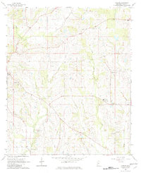
1964 Map of Linwood
USGS Topo · Published 1982About this map
The Choctaw Meridian defines the western edge of this 1964 survey, marking a primary survey line that runs through the hilly drainage basins of Yazoo County. Small rural communities like Linwood and Midway anchor a landscape dominated by a network of creeks, including Pickett Creek, Cypress Creek, and Burg Creek. The settlement pattern is characterized by scattered churches and cemeteries, many bearing family names that serve as vital leads for genealogical research.
Find a feature on this map
35 named features on this map. Tap any name to fly to it.
Don’t see what you’re looking for? This feature index may not catch every label — zoom into the map to look around manually.
Map Details
Editions of this 1964 Linwood Map
2 editions found
Other maps of this area

1955 · Jackson
USGS Topo · 1:250,000

1961 · Jackson
USGS Topo · 1:250,000

1961 · Canton
USGS Topo · 1:62,500

1961 · Valley
USGS Topo · 1:62,500

1962 · Jackson
USGS Topo · 1:250,000

1962 · Flora
USGS Topo · 1:62,500
1964 · Zeiglerville
USGS Topo · 1:24,000
1964 · Ebenezer
USGS Topo · 1:24,000

1964 · Linwood
USGS Topo · 1:24,000

1964 · Vaughan
USGS Topo · 1:24,000