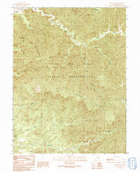
1991 Map of Lion Canyon
USGS Topo · Published 1991About this map
The Uintah and Ouray Indian Reservation dominates this 1991 provisional survey of the Grand County wilderness, where a complex network of canyons and high ridges defines the landscape. The McPherson Range stretches across the central portion of the map, separating the drainages of Florence Creek to the north from the southern waters of Coal Creek. This terrain is characterized by steep elevation changes, moving from the flat-topped Three Fords Benches down into deep incisions like Lion Canyon and Saleratus Canyon. Notable landmarks for navigation include the Natural Arch in the northwest and Dripping Springs further south. The drainage patterns of Upper Bear Canyon and Lower Bear Canyon reflect the intricate hydrological systems of this remote plateau region during the late twentieth century.
Find a feature on this map
14 named features on this map. Tap any name to fly to it.
Don’t see what you’re looking for? This feature index may not catch every label — zoom into the map to look around manually.
Map Details
Editions of this 1991 Lion Canyon Map
This is the sole edition of this map. No revisions or reprints were ever made.
Other maps of this area

1885 · East Tavaputs
USGS Topo · 1:250,000

1886 · Price River
USGS Topo · 1:250,000

1896 · Price River
USGS Topo · 1:250,000

1954 · Range Creek
USGS Topo · 1:62,500

1956 · Price
USGS Topo · 1:250,000

1956 · Grand Junction
USGS Topo · 1:250,000

1959 · Grand Junction
USGS Topo · 1:250,000

1960 · Price
USGS Topo · 1:250,000

1960 · Grand Junction
USGS Topo · 1:250,000

1962 · Grand Junction
USGS Topo · 1:250,000