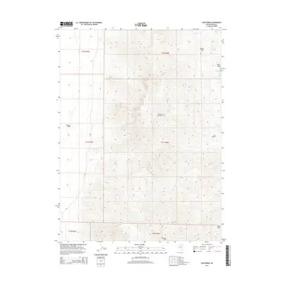
2014 Map of Lion Spring
USGS Topo · Published 2014About this map
Goshute Peak stands as the prominent landmark within the Goshute Mountains, a north-south range that dominates this high-altitude landscape. The terrain transitions sharply from the floor of the Goshute Valley on the western edge into steep, canyon-cut slopes. Water sources are scarce in this arid environment, making named features like Lion Spring, Chokecherry Spring, and Serviceberry Spring critical points of interest for historical land use and livestock movement. To the north, Morgan Basin and Spring Gulch represent the significant drainage patterns that define the mountain's northern flanks. The map illustrates a typical Great Basin topographical pattern, where vertical relief dictates the placement of trails and early survey boundaries near features like Lion Canyon and the prominent southern landmark of Black Point.
Find a feature on this map
16 named features on this map. Tap any name to fly to it.
Don’t see what you’re looking for? This feature index may not catch every label — zoom into the map to look around manually.
Map Details
Editions of this 2014 Lion Spring Map
This is the sole edition of this map. No revisions or reprints were ever made.
Other maps of this area

1955 · Elko
USGS Topo · 1:250,000

1958 · Elko
USGS Topo · 1:250,000

1962 · Elko
USGS Topo · 1:250,000

1965 · Elko
USGS Topo · 1:250,000

1971 · Decoy
USGS Topo · 1:24,000

1972 · Morgan Pass
USGS Topo · 1:24,000

1972 · Lion Spring
USGS Topo · 1:24,000

1972 · Ferguson Mtn.
USGS Topo · 1:24,000

1972 · Ola
USGS Topo · 1:24,000
1972 · Spring Gulch
USGS Topo · 1:24,000