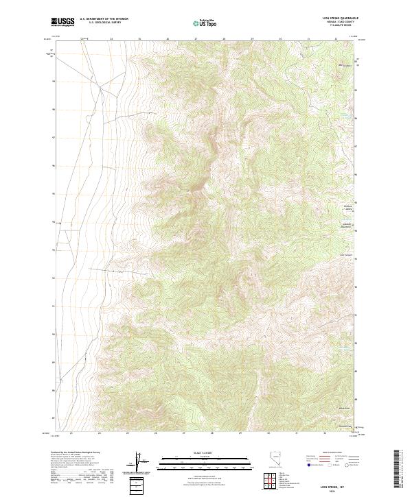
2021 Map of Lion Spring
USGS Topo · Published 2021About this map
Goshute Peak rises as a prominent landmark in this high-altitude corner of Elko County, where the steep ridgelines of the Goshute Mountains meet the broad expanse of the Goshute Valley. The landscape is defined by its verticality and the critical presence of isolated water sources in an otherwise arid environment. Names like Chokecherry Springs and Serviceberry Spring suggest the native flora that clusters around these rare riparian spots, while the namesake Lion Spring sits tucked into the drainages below Lion Canyon. The topography here is intricate, showing the transition from the high basin of Morgan Basin in the north to the distinctive volcanic or rocky prominence of Black Point at the southern boundary. This map captures a quintessential Great Basin landform where hydrology and elevation dictate the naming of every reliable spring and canyon.
Find a feature on this map
15 named features on this map. Tap any name to fly to it.
Don’t see what you’re looking for? This feature index may not catch every label — zoom into the map to look around manually.
Map Details
Editions of this 2021 Lion Spring Map
This is the sole edition of this map. No revisions or reprints were ever made.
Other maps of this area

1955 · Elko
USGS Topo · 1:250,000

1958 · Elko
USGS Topo · 1:250,000

1962 · Elko
USGS Topo · 1:250,000

1965 · Elko
USGS Topo · 1:250,000

1971 · Decoy
USGS Topo · 1:24,000

1972 · Morgan Pass
USGS Topo · 1:24,000

1972 · Lion Spring
USGS Topo · 1:24,000

1972 · Ferguson Mtn.
USGS Topo · 1:24,000

1972 · Ola
USGS Topo · 1:24,000
1972 · Spring Gulch
USGS Topo · 1:24,000