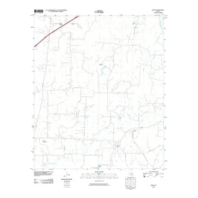
2010 Map of Lipan
USGS Topo · Published 2010About this map
Lipan and the surrounding Hood County countryside are defined by a network of seasonal creeks and family-named landmarks. The settlement of New Salem sits in the northwest corner, while the larger community of Lipan serves as the local anchor to the south. The drainage patterns of Kickapoo Creek, Dry Branch Kickapoo Creek, and Crockery Creek carve through the landscape, eventually feeding toward the Brazos River at the eastern edge. Notable elevations like Potato Hill and Double Mountain break the horizon, providing vertical relief in an area primarily used for ranching and agriculture.
Find a feature on this map
46 named features on this map. Tap any name to fly to it.
Don’t see what you’re looking for? This feature index may not catch every label — zoom into the map to look around manually.
Map Details
Editions of this 2010 Lipan Map
This is the sole edition of this map. No revisions or reprints were ever made.
Other maps of this area

1889 · Granbury
USGS Topo · 1:125,000

1890 · Stephenville
USGS Topo · 1:125,000

1891 · Weatherford
USGS Topo · 1:125,000

1891 · Palo Pinto
USGS Topo · 1:125,000

1893 · Weatherford
USGS Topo · 1:125,000

1918 · Palo Pinto
USGS Topo · 1:125,000

1920 · Stephenville
USGS Topo · 1:125,000

1925 · Palo Pinto 4-b
USGS Topo · 1:48,000

1931 · Dennis
USGS Topo · 1:62,500

1931 · Santo
USGS Topo · 1:62,500