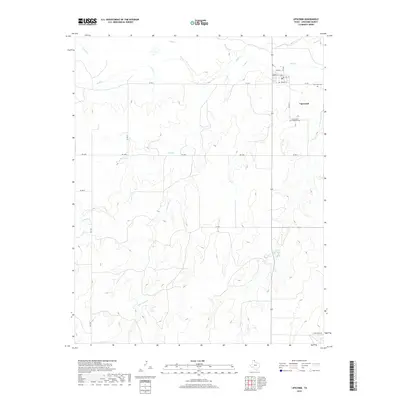
2019 Map of Lipscomb
USGS Topo · Published 2019About this map
Lipscomb is the central hub of this High Plains landscape, situated along the northern banks of Wolf Cr. The town's grid is clearly defined by Main St, 4th Ave, and Plum St, serving as the seat of local activity in this rural portion of the Texas Panhandle. Two primary burial grounds, Lipscomb Cem and Saint John's Lutheran Cem, provide important locations for genealogical research and historical study of the area's early families. The surrounding terrain is heavily dissected by numerous watercourses, including Sand Cr, Little Sand Cr, and Plum Cr, which create a complex drainage pattern across the plateau. A network of rural routes like Kirk Ranch Rd and various county roads connects the isolated ranching properties to the village center.
Find a feature on this map
26 named features on this map. Tap any name to fly to it.
Don’t see what you’re looking for? This feature index may not catch every label — zoom into the map to look around manually.
Map Details
Editions of this 2019 Lipscomb Map
This is the sole edition of this map. No revisions or reprints were ever made.
Other maps of this area

1954 · Perryton
USGS Topo · 1:250,000

1958 · Perryton
USGS Topo · 1:250,000

1972 · Barton Corners
USGS Topo · 1:24,000

1972 · Dugout Creek
USGS Topo · 1:24,000

1972 · Skunk Creek
USGS Topo · 1:24,000

1972 · Glazier
USGS Topo · 1:24,000

1972 · Willow Creek
USGS Topo · 1:24,000

1972 · Lipscomb
USGS Topo · 1:24,000
1972 · Lipscomb SW
USGS Topo · 1:24,000
1972 · Coburn
USGS Topo · 1:24,000