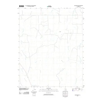
2010 Map of Lipscomb SW
USGS Topo · Published 2010About this map
Kelln Oil Field sits at the center of this rural landscape in Lipscomb County, marking the local energy production that defines the region's modern economy. The terrain is defined by a dense network of drainage systems, including the southward-reaching West Horse Creek and Horse Creek, which carve through the plains. The eastern portion of the sheet is dominated by the upper reaches of Big Timber Creek and its tributary, East Prong Big Timber Creek. The settlement pattern is sparse and largely structured by a rigid grid of local routes like Locust Grove and Co RD DD. This layout reflects the late 20th-century agricultural and industrial organization of the Texas Panhandle, where transport lines often follow section boundaries to connect isolated extraction sites and ranch lands.
Find a feature on this map
11 named features on this map. Tap any name to fly to it.
Don’t see what you’re looking for? This feature index may not catch every label — zoom into the map to look around manually.
Map Details
Editions of this 2010 Lipscomb SW Map
This is the sole edition of this map. No revisions or reprints were ever made.
Other maps of this area

1954 · Perryton
USGS Topo · 1:250,000

1954 · Amarillo
USGS Topo · 1:250,000

1958 · Perryton
USGS Topo · 1:250,000

1958 · Amarillo
USGS Topo · 1:250,000

1972 · Barton Corners
USGS Topo · 1:24,000

1972 · Canadian West
USGS Topo · 1:24,000

1972 · East Dry Creek
USGS Topo · 1:24,000

1972 · Canadian East
USGS Topo · 1:24,000

1972 · Glazier
USGS Topo · 1:24,000

1972 · Lipscomb
USGS Topo · 1:24,000