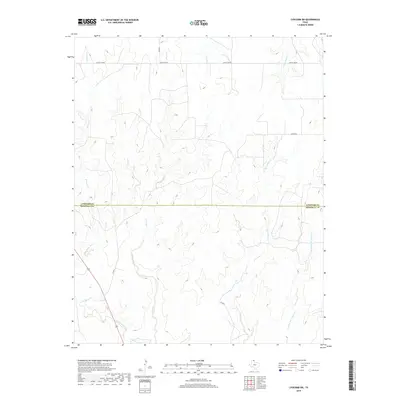
2019 Map of Lipscomb SW
USGS Topo · Published 2019About this map
Locust Grove defines the northern reaches of this High Plains landscape where the Texas Panhandle begins its gradual slope toward the Canadian River valley. The terrain is deeply inscribed by a dendritic drainage network, with the headwaters of West Horse Creek and Horse Creek carving significant relief into the plateau. This 2019 survey documents a sparsely populated ranching and agricultural region on the boundary between Lipscomb and Hemphill counties. Transportation in this corner of the state relies on a grid of section-line roads such as Co RD 6 and Co RD DD, which navigate the draws formed by Big Timber Creek and its various tributaries. The map reveals the intricate water systems essential to this environment, including the S Prong Sand Cr and the deeply etched E Prong Big Timber Cr.
Find a feature on this map
14 named features on this map. Tap any name to fly to it.
Don’t see what you’re looking for? This feature index may not catch every label — zoom into the map to look around manually.
Map Details
Editions of this 2019 Lipscomb SW Map
This is the sole edition of this map. No revisions or reprints were ever made.
Other maps of this area

1954 · Perryton
USGS Topo · 1:250,000

1954 · Amarillo
USGS Topo · 1:250,000

1958 · Perryton
USGS Topo · 1:250,000

1958 · Amarillo
USGS Topo · 1:250,000

1972 · Barton Corners
USGS Topo · 1:24,000

1972 · Canadian West
USGS Topo · 1:24,000

1972 · East Dry Creek
USGS Topo · 1:24,000

1972 · Canadian East
USGS Topo · 1:24,000

1972 · Glazier
USGS Topo · 1:24,000

1972 · Lipscomb
USGS Topo · 1:24,000