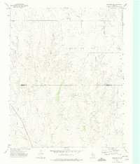
1972 Map of Lipscomb SW
USGS Topo · Published 1974About this map
The Kelln Oil Field dominates the high plains of the Texas Panhandle in this early 1970s landscape, illustrating the intensive energy infrastructure across the northern border of Lipscomb Co and Hemphill Co. The terrain is defined by a dense network of drainage systems, including the complex forks of Big Timber Creek and Horse Creek, which cut through the level ranchland. A specialized industrial presence is evident through numerous oil and gas wells, a Pumping Sta, and an extensive system of pipelines that traverse the quadrangle.
Find a feature on this map
18 named features on this map. Tap any name to fly to it.
Don’t see what you’re looking for? This feature index may not catch every label — zoom into the map to look around manually.
Map Details
Editions of this 1972 Lipscomb SW Map
This is the sole edition of this map. No revisions or reprints were ever made.
Other maps of this area

1954 · Perryton
USGS Topo · 1:250,000

1954 · Amarillo
USGS Topo · 1:250,000

1958 · Perryton
USGS Topo · 1:250,000

1958 · Amarillo
USGS Topo · 1:250,000

1972 · Barton Corners
USGS Topo · 1:24,000

1972 · Canadian West
USGS Topo · 1:24,000

1972 · East Dry Creek
USGS Topo · 1:24,000

1972 · Canadian East
USGS Topo · 1:24,000

1972 · Glazier
USGS Topo · 1:24,000

1972 · Lipscomb
USGS Topo · 1:24,000