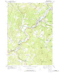
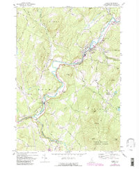
1967 Map of Lisbon
USGS Topo · Published 1977About this map
The Ammonoosuc River carves a central path through this New Hampshire landscape, serving as the historical artery for industry and transport between Bath and Lisbon. In the late 1960s, the rail infrastructure remains prominent with the Boston and Maine and Maine Central lines following the river’s contours, connecting hubs like Savageville and the Sugar Hill Sta. The map reveals a deeply rooted rural community evidenced by its distribution of local institutions, including the Blue Sch, the Center Hill Ch, and several well-established burial grounds like Grove Hill Cem.
Find a feature on this map
85 named features on this map. Tap any name to fly to it.
Don’t see what you’re looking for? This feature index may not catch every label — zoom into the map to look around manually.
Map Details
Editions of this 1967 Lisbon Map
5 editions found
Other maps of this area

1929 · Moosilauke
USGS Topo · 1:62,500

1931 · Littleton
USGS Topo · 1:62,500

1931 · Woodsville
USGS Topo · 1:48,000

1932 · Littleton
USGS Topo · 1:48,000

1932 · Moosilauke
USGS Topo · 1:62,500

1935 · Woodsville
USGS Topo · 1:62,500

1935 · Littleton
USGS Topo · 1:62,500

1938 · St. Johnsbury
USGS Topo · 1:48,000

1941 · Woodsville
USGS Topo · 1:62,500

1943 · St. Johnsbury
USGS Topo · 1:62,500