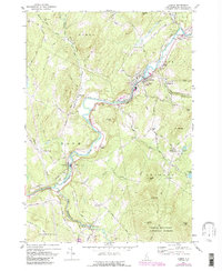
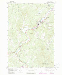
1967 Map of Lisbon
USGS Topo · Published 1988About this map
The Ammonoosuc River and its tributary, the Wild Ammonoosuc River, dictate the settlement patterns and industry of this New Hampshire region. In Lisbon, the riverfront is characterized by industrial activity including a Water Tank and several Sandpits, while the Sugar Hill Sta suggests the area's historical reliance on rail for commerce. The landscape transitions from the river valleys to the high peaks of the White Mountain National Forest, featuring landmarks like Mt Hope and Green Mtn.
Find a feature on this map
85 named features on this map. Tap any name to fly to it.
Don’t see what you’re looking for? This feature index may not catch every label — zoom into the map to look around manually.
Map Details
Editions of this 1967 Lisbon Map
5 editions found
Other maps of this area

1929 · Moosilauke
USGS Topo · 1:62,500

1931 · Littleton
USGS Topo · 1:62,500

1931 · Woodsville
USGS Topo · 1:48,000

1932 · Littleton
USGS Topo · 1:48,000

1932 · Moosilauke
USGS Topo · 1:62,500

1935 · Woodsville
USGS Topo · 1:62,500

1935 · Littleton
USGS Topo · 1:62,500

1938 · St. Johnsbury
USGS Topo · 1:48,000

1941 · Woodsville
USGS Topo · 1:62,500

1943 · St. Johnsbury
USGS Topo · 1:62,500