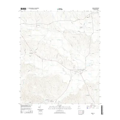
2014 Map of Lisman
USGS Topo · Published 2014About this map
Lisman and the surrounding Choctaw County landscape appear here in 2014, defined by a network of rural settlements and winding waterways. The town of Lisman sits at a junction of local roads, while the community of Riderwood occupies the southern reach of the map near Scott Mtn. Significant burial sites like Sardis Cem and Episcopal Cem near Pushmataha offer vital touchstones for family historians tracing roots in this portion of western Alabama.
Find a feature on this map
72 named features on this map. Tap any name to fly to it.
Don’t see what you’re looking for? This feature index may not catch every label — zoom into the map to look around manually.
Map Details
Editions of this 2014 Lisman Map
This is the sole edition of this map. No revisions or reprints were ever made.
Other maps of this area

1953 · Meridian
USGS Topo · 1:250,000

1957 · Meridian
USGS Topo · 1:250,000

1965 · Meridian
USGS Topo · 1:250,000

1971 · Gaston
USGS Topo · 1:24,000

1974 · Yantley
USGS Topo · 1:24,000

1974 · Ward
USGS Topo · 1:24,000

1974 · Lisman
USGS Topo · 1:24,000
1974 · Hinton
USGS Topo · 1:24,000
1974 · Land
USGS Topo · 1:24,000
1978 · Whynot
USGS Topo · 1:24,000