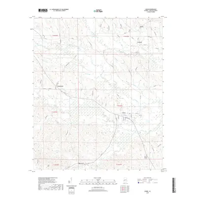
2018 Map of Lisman
USGS Topo · Published 2018About this map
Lisman anchors this portion of Choctaw County, sitting at the junction of local routes like Broad St and Crowell Cir. The landscape is defined by its many watercourses, notably the wide drainage of Bogue Chitto and its various tributaries including McCall Br and Tuckabum Cr. To the west, the settlement of Pushmataha is marked by community landmarks such as Sardis Cem and Episcopal Cem. The southern edge of the map rises toward Scott Mtn near Riderwood, illustrating the varied elevation of this Alabama timberland. Throughout the quadrangle, a dense network of country roads like Ruffintown Rd and Little Hope Rd connects smaller locales such as Cromwell and Mollie. This survey details the rural infrastructure and cemetery locations essential for genealogical research in this historic corner of the state.
Find a feature on this map
72 named features on this map. Tap any name to fly to it.
Don’t see what you’re looking for? This feature index may not catch every label — zoom into the map to look around manually.
Map Details
Editions of this 2018 Lisman Map
This is the sole edition of this map. No revisions or reprints were ever made.
Other maps of this area

1953 · Meridian
USGS Topo · 1:250,000

1957 · Meridian
USGS Topo · 1:250,000

1965 · Meridian
USGS Topo · 1:250,000

1971 · Gaston
USGS Topo · 1:24,000

1974 · Yantley
USGS Topo · 1:24,000

1974 · Ward
USGS Topo · 1:24,000

1974 · Lisman
USGS Topo · 1:24,000
1974 · Hinton
USGS Topo · 1:24,000
1974 · Land
USGS Topo · 1:24,000
1978 · Whynot
USGS Topo · 1:24,000