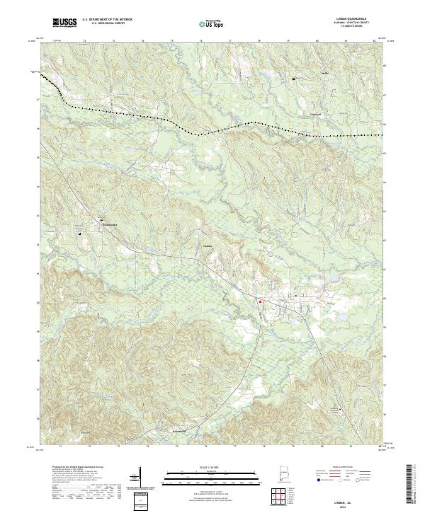
2024 Map of Lisman
USGS Topo · Published 2024About this map
Lisman sits at the heart of this Choctaw County landscape, where the terrain is defined by a dense network of tributaries including Bogue Chitto and Tuckabum Creek. To the northwest, the settlement of Pushmataha preserves a concentration of local heritage sites, specifically the Sardis Cem and Pushmataha Episcopal Cem. The map reflects a rural Alabama community structured by long-standing land divisions and small crossroads settlements like Mollie and Cromwell. Natural landmarks such as Scott Mtn rise above the creek bottoms, while the southern edge is marked by the community of Riderwood. The distribution of family and community cemeteries, including Eureka Cem near the northern boundary and Resthaven Memorial Gardens to the southeast, indicates a deeply rooted residential history tied to the drainage basins of Yantley Creek and its many branches.
Find a feature on this map
75 named features on this map. Tap any name to fly to it.
Don’t see what you’re looking for? This feature index may not catch every label — zoom into the map to look around manually.
Map Details
Editions of this 2024 Lisman Map
This is the sole edition of this map. No revisions or reprints were ever made.
Other maps of this area

1953 · Meridian
USGS Topo · 1:250,000

1957 · Meridian
USGS Topo · 1:250,000

1965 · Meridian
USGS Topo · 1:250,000

1971 · Gaston
USGS Topo · 1:24,000

1974 · Yantley
USGS Topo · 1:24,000

1974 · Ward
USGS Topo · 1:24,000

1974 · Lisman
USGS Topo · 1:24,000
1974 · Hinton
USGS Topo · 1:24,000
1974 · Land
USGS Topo · 1:24,000
1978 · Whynot
USGS Topo · 1:24,000