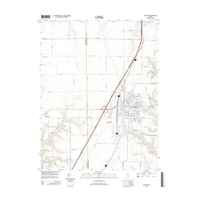
2015 Map of Litchfield
USGS Topo · Published 2015About this map
Litchfield serves as the central hub of this Central Illinois region, situated at the boundary of Macoupin and Montgomery counties. The town's grid is dense with residential and commercial activity, transitioning into a landscape defined by significant infrastructure and family-history landmarks. To the west, the small settlement of Hornsby sits near the winding course of Cahokia Creek, while the Litchfield Municipal Airport and Interstate 55 corridor represent the area's modern transportation role. Genealogists will find a high concentration of burial grounds throughout the countryside, ranging from the large Elmwood Cemetery and Elm Lawn Memorial Park near town to smaller rural sites such as Karnes Cemetery, Kinder Cemetery, and Farrar Cemetery. The local topography is carved by numerous tributaries including Threemile Branch, Shop Creek, and Crabtree Branch, which feed into local reservoirs like Walton Lake and Kilton Lake.
Find a feature on this map
125 named features on this map. Tap any name to fly to it.
Don’t see what you’re looking for? This feature index may not catch every label — zoom into the map to look around manually.
Map Details
Editions of this 2015 Litchfield Map
This is the sole edition of this map. No revisions or reprints were ever made.
Other maps of this area

1912 · Gillespie
USGS Topo · 1:62,500

1915 · Gillespie
USGS Topo · 1:62,500

1915 · Mount Olive
USGS Topo · 1:62,500

1923 · Carlinville
USGS Topo · 1:48,000

1923 · Raymond
USGS Topo · 1:62,500

1925 · Carlinville
USGS Topo · 1:62,500

1925 · Raymond
USGS Topo · 1:62,500

1931 · Carlinville
USGS Topo · 1:62,500

1944 · Mount Olive
USGS Topo · 1:62,500

1958 · Decatur
USGS Topo · 1:250,000