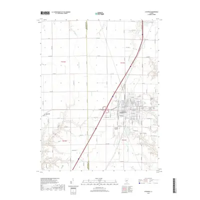
2018 Map of Litchfield
USGS Topo · Published 2018About this map
Litchfield serves as the central hub of this Central Illinois survey, showing a dense street grid punctuated by civic landmarks and a collection of significant cemeteries. To the east, Elmwood Cem and Holy Cross Cem border the town, while smaller family and local burial sites like Karnes Cem and Kinder Cem are found across the rural landscape to the west. The transition from the developed core of Litchfield to the surrounding agricultural land is defined by a network of drainage systems including Cahokia Cr and Shop Cr. The inclusion of the Litchfield Municipal Airport and the modern highway corridor illustrates the area's mid-to-late 20th-century infrastructure expansion. Local history researchers can also identify the small settlement of Hornsby and the county line between Macoupin and Montgomery counties, which cuts vertically through the quadrangle.
Find a feature on this map
104 named features on this map. Tap any name to fly to it.
Don’t see what you’re looking for? This feature index may not catch every label — zoom into the map to look around manually.
Map Details
Editions of this 2018 Litchfield Map
This is the sole edition of this map. No revisions or reprints were ever made.
Other maps of this area

1912 · Gillespie
USGS Topo · 1:62,500

1915 · Gillespie
USGS Topo · 1:62,500

1915 · Mount Olive
USGS Topo · 1:62,500

1923 · Carlinville
USGS Topo · 1:48,000

1923 · Raymond
USGS Topo · 1:62,500

1925 · Carlinville
USGS Topo · 1:62,500

1925 · Raymond
USGS Topo · 1:62,500

1931 · Carlinville
USGS Topo · 1:62,500

1944 · Mount Olive
USGS Topo · 1:62,500

1958 · Decatur
USGS Topo · 1:250,000