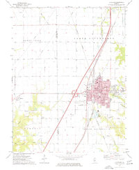
1974 Map of Litchfield
USGS Topo · Published 1977About this map
Litchfield serves as the central hub of this mid-1970s survey, showing a dense network of schools, churches, and civic buildings that anchor the community. The town is flanked by major rail lines, including the Illinois Central Gulf and the Norfolk and Western, which speak to its historical importance as a transit junction. Outside the urban center, the landscape of North Litchfield and South Litchfield transitions into productive farmland divided by the Macoupin Co Montgomery Co boundary line.
Find a feature on this map
50 named features on this map. Tap any name to fly to it.
Don’t see what you’re looking for? This feature index may not catch every label — zoom into the map to look around manually.
Map Details
Editions of this 1974 Litchfield Map
This is the sole edition of this map. No revisions or reprints were ever made.
Other maps of this area

1912 · Gillespie
USGS Topo · 1:62,500

1915 · Gillespie
USGS Topo · 1:62,500

1915 · Mount Olive
USGS Topo · 1:62,500

1923 · Carlinville
USGS Topo · 1:48,000

1923 · Raymond
USGS Topo · 1:62,500

1925 · Carlinville
USGS Topo · 1:62,500

1925 · Raymond
USGS Topo · 1:62,500

1931 · Carlinville
USGS Topo · 1:62,500

1944 · Mount Olive
USGS Topo · 1:62,500

1958 · Decatur
USGS Topo · 1:250,000