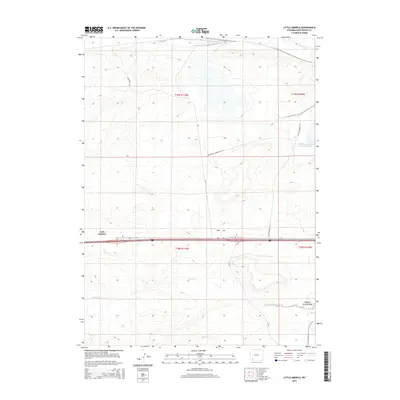
2015 Map of Little America
USGS Topo · Published 2015About this map
Little America serves as the focal point of this Sweetwater County landscape, positioned along the busy transportation corridor of Interstate 80. The high desert terrain is defined by ephemeral waterways such as Spider Cr and Meadow Springs Wash, while Blacks Fork cuts through the northern reaches of the quadrangle. Industrial infrastructure is a prominent feature of the local economy and land use, evidenced by the presence of Allied Chemical Rd, the Allied-Fmc Connector Rd, and specialized facilities like the Solid Waste Disposal Cell-H Reservoir. Historically significant routes, including Westvaco Rd, weave through the sagebrush flats, connecting various township sections across the high plains of southern Wyoming during this mid-2010s period.
Find a feature on this map
14 named features on this map. Tap any name to fly to it.
Don’t see what you’re looking for? This feature index may not catch every label — zoom into the map to look around manually.
Map Details
Editions of this 2015 Little America Map
This is the sole edition of this map. No revisions or reprints were ever made.
Other maps of this area

1954 · Rock Springs
USGS Topo · 1:250,000

1957 · Mc Kinnon Junction
USGS Topo · 1:62,500

1958 · Rock Springs
USGS Topo · 1:250,000

1961 · Blue Point
USGS Topo · 1:24,000

1961 · Little America
USGS Topo · 1:24,000

1961 · Sevenmile Gulch
USGS Topo · 1:24,000

1961 · Granger
USGS Topo · 1:24,000

1961 · Stevens Flat
USGS Topo · 1:24,000

1961 · Bryan
USGS Topo · 1:24,000

1962 · Rock Springs
USGS Topo · 1:250,000