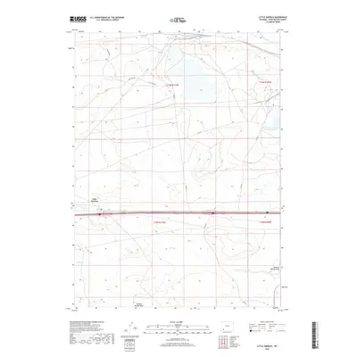
2018 Map of Little America
USGS Topo · Published 2018About this map
Little America serves as the focal point of this Sweetwater County landscape, situated along a primary transportation corridor in southwestern Wyoming. The area is defined by its arid geography and a network of service roads, including Westvaco Rd and Fmc Rd, which reflect the region's industrial and logistical importance. Water features are sparse but significant, with Blacks Fork cutting across the northeastern corner and the seasonal drainage of Meadow Springs Wash and Spider Cr marking the southern reaches. The presence of the Solid Waste Disposal Cell-H-Reservoir indicates modern land management and utility infrastructure essential to the area's development. This survey provides a clear view of how man-made corridors and industrial footprints have integrated into the High Desert terrain of the Green River Basin.
Find a feature on this map
14 named features on this map. Tap any name to fly to it.
Don’t see what you’re looking for? This feature index may not catch every label — zoom into the map to look around manually.
Map Details
Editions of this 2018 Little America Map
This is the sole edition of this map. No revisions or reprints were ever made.
Other maps of this area

1954 · Rock Springs
USGS Topo · 1:250,000

1957 · Mc Kinnon Junction
USGS Topo · 1:62,500

1958 · Rock Springs
USGS Topo · 1:250,000

1961 · Blue Point
USGS Topo · 1:24,000

1961 · Little America
USGS Topo · 1:24,000

1961 · Sevenmile Gulch
USGS Topo · 1:24,000

1961 · Granger
USGS Topo · 1:24,000

1961 · Stevens Flat
USGS Topo · 1:24,000

1961 · Bryan
USGS Topo · 1:24,000

1962 · Rock Springs
USGS Topo · 1:250,000