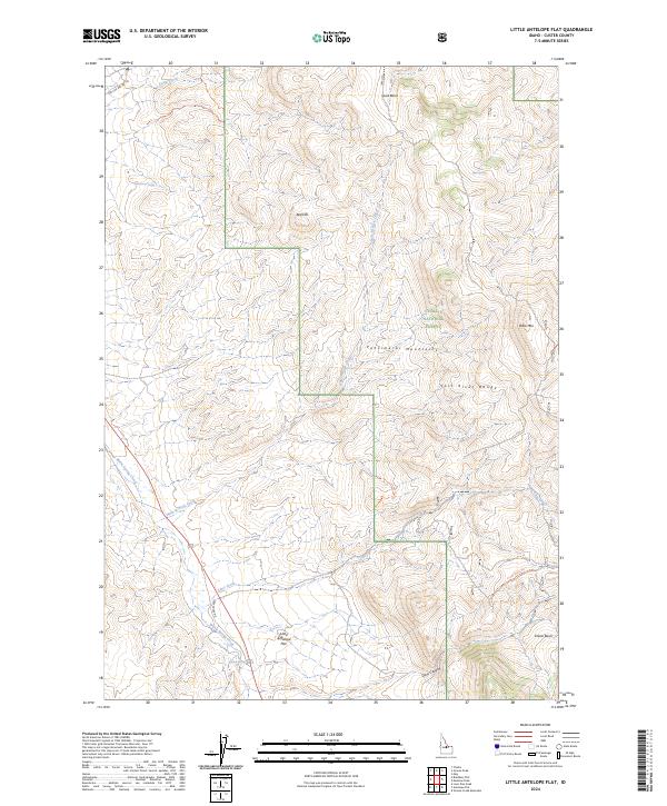
2024 Map of Little Antelope Flat
USGS Topo · Published 2024About this map
Little Antelope Flat serves as a central landmark in this high-altitude landscape where the Pahsimeroi Mountains and Lost River Range converge. Located within the Challis National Forest, the area is defined by sharp topographic shifts and essential water sources that have historically supported transit and grazing. Features like Gooseberry Spring, Opal Spring, and Warm Spring indicate the critical role of hydrology in this environment. Movement through the complex terrain is facilitated by Lime Creek Rd and the Crane Basin Trl, which navigate between prominent elevations such as Red Hill and Table Mtn. The survey also documents the steep descent into Devil Canyon and the high-altitude Spud Basin, offering a modern look at this segment of Custer County.
Find a feature on this map
26 named features on this map. Tap any name to fly to it.
Don’t see what you’re looking for? This feature index may not catch every label — zoom into the map to look around manually.
Map Details
Editions of this 2024 Little Antelope Flat Map
This is the sole edition of this map. No revisions or reprints were ever made.
Other maps of this area

1929 · Bayhorse
USGS Topo · 1:125,000

1935 · Borah Peak
USGS Topo · 1:125,000

1938 · Borah Peak
USGS Topo · 1:125,000

1955 · Dubois
USGS Topo · 1:250,000

1956 · Doublespring
USGS Topo · 1:62,500

1956 · May
USGS Topo · 1:62,500

1956 · Challis
USGS Topo · 1:62,500

1957 · Challis
USGS Topo · 1:250,000

1958 · Dubois
USGS Topo · 1:250,000

1960 · Challis
USGS Topo · 1:250,000