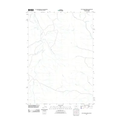
2011 Map of Little Bear Creek
USGS Topo · Published 2011About this map
Owl Creek and Little Bear Creek dominate this landscape along the Montana-Wyoming border, where a complex network of drainage basins defines the topography of Sheridan County. The area is characterized by high plains terrain, where water sources are vital landmarks, such as the uniquely identified 08S37E26ACAC01 Spring located in the northern reaches. This 2011 survey illustrates a region largely defined by its natural watercourses and sparse infrastructure, with transportation limited to established routes like County Rd 125 and Bear Creek Rd. Several significant tributaries, including Youngs Creek, Ash Creek, and Little Youngs Creek, converge across the quadrangle, indicating the watershed importance of this borderland area. For researchers, the map provides precise locations for family-named drainages like Wolf Creek and Squirrel Creek as they existed in the early 21st century.
Find a feature on this map
15 named features on this map. Tap any name to fly to it.
Don’t see what you’re looking for? This feature index may not catch every label — zoom into the map to look around manually.
Map Details
Editions of this 2011 Little Bear Creek Map
This is the sole edition of this map. No revisions or reprints were ever made.
Other maps of this area

1894 · Rosebud
USGS Topo · 1:125,000

1895 · Dayton
USGS Topo · 1:125,000

1901 · Rosebud
USGS Topo · 1:125,000

1901 · Dayton
USGS Topo · 1:125,000

1954 · Hardin
USGS Topo · 1:250,000

1955 · Sheridan
USGS Topo · 1:250,000

1957 · Hardin
USGS Topo · 1:250,000

1958 · Hardin
USGS Topo · 1:250,000

1958 · Sheridan
USGS Topo · 1:250,000

1962 · Sheridan
USGS Topo · 1:250,000