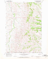
1967 Map of Little Bear Creek
USGS Topo · Published 1971About this map
The Wolf Mountains dominate this high-plains landscape along the border of Montana and Wyoming. Surveyed in the late 1960s, the terrain is defined by a dense network of drainages including Little Bear Creek, Wolf Creek, and Youngs Creek, which carve through the elevations east of the Crow Indian Reservation Boundary. The map documents a sparsely settled ranching and wilderness environment where transportation is limited to an unimproved Jeep Trail and the established Line Rider Creek Trail. Notable landmarks such as the Bull Hole spring and numerous seasonal water sources like Ash Creek and Squirrel Creek reveal the importance of water management in this arid grazing country. The map captures the exact line where Big Horn County, Montana, meets Sheridan County, Wyoming, providing a precise record of the jurisdictional and physical landscape during this era.
Find a feature on this map
22 named features on this map. Tap any name to fly to it.
Don’t see what you’re looking for? This feature index may not catch every label — zoom into the map to look around manually.
Map Details
Editions of this 1967 Little Bear Creek Map
This is the sole edition of this map. No revisions or reprints were ever made.
Other maps of this area

1894 · Rosebud
USGS Topo · 1:125,000

1895 · Dayton
USGS Topo · 1:125,000

1901 · Rosebud
USGS Topo · 1:125,000

1901 · Dayton
USGS Topo · 1:125,000

1954 · Hardin
USGS Topo · 1:250,000

1955 · Sheridan
USGS Topo · 1:250,000

1957 · Hardin
USGS Topo · 1:250,000

1958 · Hardin
USGS Topo · 1:250,000

1958 · Sheridan
USGS Topo · 1:250,000

1962 · Sheridan
USGS Topo · 1:250,000