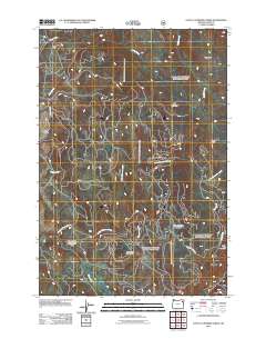
2011 Map of Little Catherine Creek
USGS Topo · Published 2011About this map
Catherine Creek State Park anchors the southwestern portion of this Union County landscape, where the terrain transitions from the low-lying High Valley into the forested uplands of the Blue Mountains. The drainage system of Little Catherine Creek and its many tributaries, such as Lick Creek and Dobbin Creek, defines the local geography. Human passage and early water management are evident in the presence of the Elmer Ditch and primitive routes like Merry-Go-Round Rd.
Find a feature on this map
17 named features on this map. Tap any name to fly to it.
Don’t see what you’re looking for? This feature index may not catch every label — zoom into the map to look around manually.
Map Details
Editions of this 2011 Little Catherine Creek Map
This is the sole edition of this map. No revisions or reprints were ever made.
Other maps of this area

1906 · Telocaset
USGS Topo · 1:125,000

1955 · Grangeville
USGS Topo · 1:250,000

1959 · Grangeville
USGS Topo · 1:250,000

1965 · China Cap
USGS Topo · 1:24,000

1965 · Flagstaff Butte
USGS Topo · 1:24,000

1965 · Union
USGS Topo · 1:24,000

1965 · Medical Springs
USGS Topo · 1:24,000

1965 · Cove
USGS Topo · 1:24,000

1965 · Little Catherine Creek
USGS Topo · 1:24,000
1965 · Telocaset
USGS Topo · 1:24,000