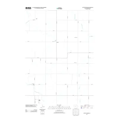
2013 Map of Little Cedar
USGS Topo · Published 2013About this map
The Little Cedar River and the Wapsipinicon River define the agricultural landscape of this Mitchell County corner, where a strict section-line grid of rural roads connects multi-generational farmsteads. The unincorporated community of Little Cedar sits at the southern edge of the sheet, while the small settlement of Meyer serves as a northern waypoint for local travel. Named agricultural sites such as Pronet Farms, McCarthy Farms, and Winkels Farm emphasize the region's enduring farming legacy into the 21st century. Infrastructure is localized, characterized by crossings like the Little Cedar River Bridge and the path of Beaver Cr as it winds through the eastern fields. The map documents a classic Iowa interior where the river systems dictate the subtle deviations in an otherwise orderly township geometry.
Find a feature on this map
28 named features on this map. Tap any name to fly to it.
Don’t see what you’re looking for? This feature index may not catch every label — zoom into the map to look around manually.
Map Details
Editions of this 2013 Little Cedar Map
This is the sole edition of this map. No revisions or reprints were ever made.
Other maps of this area

1954 · Austin
USGS Topo · 1:62,500

1954 · Mason City
USGS Topo · 1:250,000

1957 · Mason City
USGS Topo · 1:250,000

1958 · Mason City
USGS Topo · 1:250,000

1965 · Le Roy
USGS Topo · 1:24,000

1965 · Adams
USGS Topo · 1:24,000

1972 · Osage
USGS Topo · 1:24,000

1972 · Mc Intire
USGS Topo · 1:24,000

1972 · Little Cedar
USGS Topo · 1:24,000

1972 · New Haven
USGS Topo · 1:24,000