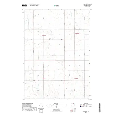
2018 Map of Little Cedar
USGS Topo · Published 2018About this map
Little Cedar River and the Wapsipinicon River define the agricultural landscape of this Mitchell County quadrangle, where the small community of Meyer stands as the primary residential hub. The map reveals a traditional Iowa section-line grid, punctuated by landmarks essential to the local social fabric, including Sacred Heart Cem near Meyer and Saint Patrick Cem further east. The terrain is characterized by the winding paths of these two rivers and smaller tributaries like Beaver Cr, which cross a network of rural routes such as Primrose Ave and Timber Ave. For those tracing local history, the placement of the Little Cedar River Bridge and various country graveyards like Robbins Cem and Liberty Cem provides a detailed look at the rural infrastructure and early settlement patterns of north-central Iowa in the early 21st century.
Find a feature on this map
34 named features on this map. Tap any name to fly to it.
Don’t see what you’re looking for? This feature index may not catch every label — zoom into the map to look around manually.
Map Details
Editions of this 2018 Little Cedar Map
This is the sole edition of this map. No revisions or reprints were ever made.
Other maps of this area

1954 · Austin
USGS Topo · 1:62,500

1954 · Mason City
USGS Topo · 1:250,000

1957 · Mason City
USGS Topo · 1:250,000

1958 · Mason City
USGS Topo · 1:250,000

1965 · Le Roy
USGS Topo · 1:24,000

1965 · Adams
USGS Topo · 1:24,000

1972 · Osage
USGS Topo · 1:24,000

1972 · Mc Intire
USGS Topo · 1:24,000

1972 · Little Cedar
USGS Topo · 1:24,000

1972 · New Haven
USGS Topo · 1:24,000