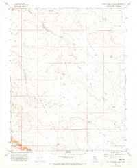
1971 Map of Little Clayhole Valley
USGS Topo · Published 1973About this map
Upper Clayhole Valley and the neighboring Antelope Valley define the drainage patterns of this high desert landscape in Mohave County. In the early 1970s, the area's water management is visible through a network of catchments and improved watering holes, including the Big Dike Reservoir, Cement Dam Res, and the Upper Clayhole Reservoirs. These features, alongside the Clayhole Well and various named ponds like Lang Pond and Resource Pond, illustrate the infrastructure required for ranching in an arid environment. The terrain is marked by the distinct The Black Rocks and Seven Knolls in the southwest corner, while the seasonal flow of Clayhole Wash and Little Clayhole Wash carves through the central valley floors. Scattered infrastructure such as cattle guards and isolated drill holes suggest a landscape focused on livestock and resource exploration.
Find a feature on this map
24 named features on this map. Tap any name to fly to it.
Don’t see what you’re looking for? This feature index may not catch every label — zoom into the map to look around manually.
Map Details
Editions of this 1971 Little Clayhole Valley Map
This is the sole edition of this map. No revisions or reprints were ever made.
Other maps of this area

1886 · Mt. Trumbull
USGS Topo · 1:250,000

1886 · Kaibab
USGS Topo · 1:250,000

1892 · Mt. Trumbull
USGS Topo · 1:250,000

1953 · Grand Canyon
USGS Topo · 1:250,000

1954 · Heaton Knolls NW
USGS Topo · 1:24,000

1954 · Lost Spring SE
USGS Topo · 1:24,000
1954 · Short Creek SW
USGS Topo · 1:24,000
1954 · Lost Spring Mtn
USGS Topo · 1:62,500

1954 · Short Creek
USGS Topo · 1:62,500

1954 · Heaton Knolls
USGS Topo · 1:62,500