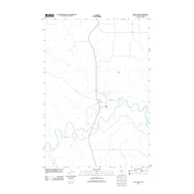
2012 Map of Little Eagle
USGS Topo · Published 2012About this map
Little Eagle sits at the center of this landscape, positioned along the northern banks of the meandering Grand River. This early 21st-century survey illustrates a settlement patterns defined by its relationship to the river and the surrounding high ground of the Standing Rock Reservation. The geography is anchored by Elk Butte to the north, providing a prominent landmark over the drainage basins of Little Oak Cr and the river valley. Local infrastructure is represented by a network of rural routes, including Firesteel Rd and Maxon Rd, which connect the community to the wider Corson County area. Genealogy and local history researchers will find the location of Saint Pauls Cem on Cemetery Rd particularly useful for identifying historical burials and familial ties to this specific reach of the river.
Find a feature on this map
10 named features on this map. Tap any name to fly to it.
Don’t see what you’re looking for? This feature index may not catch every label — zoom into the map to look around manually.
Map Details
Editions of this 2012 Little Eagle Map
This is the sole edition of this map. No revisions or reprints were ever made.
Other maps of this area

1953 · McIntosh
USGS Topo · 1:250,000

1956 · Little Eagle SW
USGS Topo · 1:24,000

1956 · Wakpala NW
USGS Topo · 1:24,000

1956 · Little Eagle
USGS Topo · 1:24,000

1956 · Little Eagle SE
USGS Topo · 1:24,000

1956 · Little Eagle NW
USGS Topo · 1:24,000

1956 · Wakpala SW
USGS Topo · 1:24,000

1958 · McIntosh
USGS Topo · 1:250,000

1966 · McLaughlin
USGS Topo · 1:24,000

1966 · Mahto
USGS Topo · 1:24,000