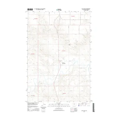
2015 Map of Little Eagle
USGS Topo · Published 2015About this map
The settlement of Little Eagle is situated along the northern banks of the meandering Grand River, where the prairie landscape is defined by the prominent elevation of Elk Butte. This 2015 USGS survey illustrates the modern layout of the community, where local infrastructure is tied to Bureau of Indian Affairs routes like Bia Rd 4 and Bia Rd 10. The presence of Saint Pauls Cem, accessed via Cemetery Rd, offers a specific point of interest for genealogists tracking family history within this portion of the Standing Rock Reservation. The geography is characterized by the river's extensive floodplain and the surrounding rolling uplands, with the survey capturing the intersection of section lines and contemporary roads such as Maxon Rd.
Find a feature on this map
18 named features on this map. Tap any name to fly to it.
Don’t see what you’re looking for? This feature index may not catch every label — zoom into the map to look around manually.
Map Details
Editions of this 2015 Little Eagle Map
This is the sole edition of this map. No revisions or reprints were ever made.
Other maps of this area

1953 · McIntosh
USGS Topo · 1:250,000

1956 · Little Eagle SW
USGS Topo · 1:24,000

1956 · Wakpala NW
USGS Topo · 1:24,000

1956 · Little Eagle
USGS Topo · 1:24,000

1956 · Little Eagle SE
USGS Topo · 1:24,000

1956 · Little Eagle NW
USGS Topo · 1:24,000

1956 · Wakpala SW
USGS Topo · 1:24,000

1958 · McIntosh
USGS Topo · 1:250,000

1966 · McLaughlin
USGS Topo · 1:24,000

1966 · Mahto
USGS Topo · 1:24,000