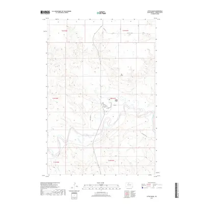
2017 Map of Little Eagle
USGS Topo · Published 2017About this map
The Little Eagle settlement stands at a sharp bend in the Grand River in Corson County, South Dakota. This 2017 survey shows a community anchored by local institutions including Saint Pauls Cem and the Catholic Cem, both located west of the town center near Cemetery Rd. The surrounding landscape is characterized by the winding river valley and distinctive high points like Elk Butte and Elk Horn. Local transportation relies on a network of rural routes such as Old Hwy 12 and Golden Eagle Dr, while the southern reaches are marked by ranching-related infrastructure like J&R Angus Ranch Rd. The map illustrates the contemporary settlement pattern of the Standing Rock Indian Reservation, where residential clusters meet the natural topography of the river breaks.
Find a feature on this map
22 named features on this map. Tap any name to fly to it.
Don’t see what you’re looking for? This feature index may not catch every label — zoom into the map to look around manually.
Map Details
Editions of this 2017 Little Eagle Map
This is the sole edition of this map. No revisions or reprints were ever made.
Other maps of this area

1953 · McIntosh
USGS Topo · 1:250,000

1956 · Little Eagle SW
USGS Topo · 1:24,000

1956 · Wakpala NW
USGS Topo · 1:24,000

1956 · Little Eagle
USGS Topo · 1:24,000

1956 · Little Eagle SE
USGS Topo · 1:24,000

1956 · Little Eagle NW
USGS Topo · 1:24,000

1956 · Wakpala SW
USGS Topo · 1:24,000

1958 · McIntosh
USGS Topo · 1:250,000

1966 · McLaughlin
USGS Topo · 1:24,000

1966 · Mahto
USGS Topo · 1:24,000