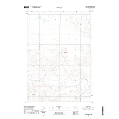
2017 Map of Little Eagle NW
USGS Topo · Published 2017About this map
Grand River meanders across the southern portion of this landscape, carving a wide valley floor marked by seasonal wetlands and small sandbars. This 2017 survey by the U.S. Geological Survey illustrates a sparsely populated reach of Corson County where the terrain is defined by undulating drainage patterns and elevated ridges. Transportation through this rural stretch is limited to a few primary routes, such as Grand River Rd and Firesteel Rd, which follow the contours of the river valley. In the southeastern corner, High Bank Cr joins the larger drainage system, while 261 Ave provides a vertical section-line corridor through the hills. The map captures the systematic organization of the Public Land Survey System, showing township and range divisions like t20n r26e that govern this quiet agricultural and ranching territory.
Find a feature on this map
11 named features on this map. Tap any name to fly to it.
Don’t see what you’re looking for? This feature index may not catch every label — zoom into the map to look around manually.
Map Details
Editions of this 2017 Little Eagle NW Map
This is the sole edition of this map. No revisions or reprints were ever made.
Other maps of this area

1953 · McIntosh
USGS Topo · 1:250,000

1956 · Little Eagle SW
USGS Topo · 1:24,000

1956 · Little Eagle
USGS Topo · 1:24,000

1956 · Little Eagle SE
USGS Topo · 1:24,000

1956 · Bullhead
USGS Topo · 1:24,000

1956 · Miscol SE
USGS Topo · 1:24,000

1956 · Little Eagle NW
USGS Topo · 1:24,000

1956 · Miscol NE
USGS Topo · 1:24,000

1958 · McIntosh
USGS Topo · 1:250,000

1966 · McLaughlin
USGS Topo · 1:24,000