
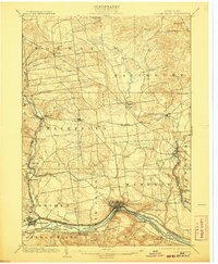
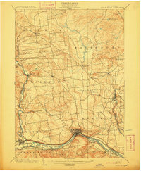
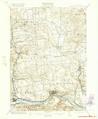
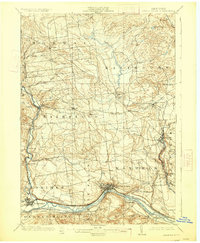
1903 Map of Little Falls
USGS Topo · Published 1903About this map
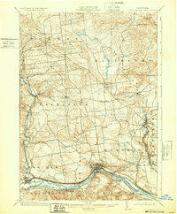
The Mohawk River corridor serves as the industrial and transit heart of this region at the turn of the century, defined by the parallel paths of the Erie Canal and the New York Central and Hudson River R. R. The city of Little Falls anchors the southern landscape, where the river cuts through the terrain near the Herkimer Monument and the historic site of Fort Herkimer. Northward, the topography shifts toward the foothills of the Adirondacks, dotted with smaller manufacturing and agricultural centers like Dolgeville on East Canada Creek and the tannery and mill sites of Salisbury Center.
Find a feature on this map
59 named features on this map. Tap any name to fly to it.
Don’t see what you’re looking for? This feature index may not catch every label — zoom into the map to look around manually.
Map Details
Editions of this 1903 Little Falls Map
6 editions found
Other maps of this area

1897 · Remsen
USGS Topo · 1:62,500

1898 · Utica
USGS Topo · 1:62,500

1898 · Canajoharie
USGS Topo · 1:62,500

1900 · Little Falls
USGS Topo · 1:62,500

1900 · Utica
USGS Topo · 1:62,500

1900 · Canajoharie
USGS Topo · 1:62,500

1900 · Remsen
USGS Topo · 1:62,500

1900 · Wilmurt
USGS Topo · 1:62,500

1901 · Lassellsville
USGS Topo · 1:62,500

1902 · Canajoharie
USGS Topo · 1:62,500