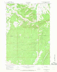
1965 Map of Little Goose Peak
USGS Topo · Published 1968About this map
Bighorn National Forest dominates this mid-1960s survey of the high country straddling the Sheridan and Johnson county line. The landscape is defined by the headwaters of the Little Goose Creek system, including its West Fork and East Fork, as they descend from the prominent Little Goose Peak. An important local historical marker is found at the Historical Site (Gen Crooks Camp) near Red Hill, identifying a military encampment in the rugged Big Horn terrain. The map details a network of high-altitude infrastructure, from the Penrose Guard Station to several seasonal outposts like Cow Camp and Gallatin Cow Camp. Early transportation routes are meticulously traced, including the winding Red Grade Road and numerous pack trails such as the Stockwell Trail and Penrose Park Trail, which provided access to remote features like Kenny Wood Park and Poverty Flat.
Find a feature on this map
29 named features on this map. Tap any name to fly to it.
Don’t see what you’re looking for? This feature index may not catch every label — zoom into the map to look around manually.
Map Details
Editions of this 1965 Little Goose Peak Map
2 editions found
Other maps of this area

1895 · Dayton
USGS Topo · 1:125,000

1899 · Cloud peak
USGS Topo · 1:125,000

1900 · Fort McKinney
USGS Topo · 1:125,000

1901 · Cloud Peak
USGS Topo · 1:125,000

1901 · Dayton
USGS Topo · 1:125,000

1903 · Fort McKinney
USGS Topo · 1:125,000

1909 · Sheridan
USGS Topo · 1:125,000

1911 · Sheridan
USGS Topo · 1:125,000

1955 · Sheridan
USGS Topo · 1:250,000

1958 · Sheridan
USGS Topo · 1:250,000