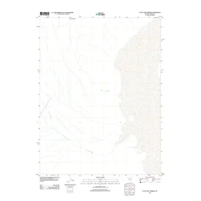
2012 Map of Little Hot Springs
USGS Topo · Published 2012About this map
Little Hot Springs and Hot Springs punctuate this high-desert landscape in Lander County, signaling the thermal activity common to this stretch of the Great Basin. The terrain is defined by the eastern slopes of the Toiyabe Range, where drainage patterns move from the high ground toward the valley floor. Dry Canyon Wash serves as a primary drainage route, carving through the alluvial fans that spread across the quadrangle. Aside from these vital water sources, such as Crow Spring, the area remains largely undeveloped, preserving a wilderness character that has changed little since the early settlement of Nevada. This survey documents the intersection of geology and hydrology, showing how isolated springs provide the only reliable moisture in an otherwise arid expanse of the basin-and-range province.
Find a feature on this map
5 named features on this map. Tap any name to fly to it.
Don’t see what you’re looking for? This feature index may not catch every label — zoom into the map to look around manually.
Map Details
Editions of this 2012 Little Hot Springs Map
This is the sole edition of this map. No revisions or reprints were ever made.
Other maps of this area

1926 · Roberts Mountains
USGS Topo · 1:250,000

1929 · Roberts Mountains
USGS Topo · 1:250,000

1938 · Cortez
USGS Topo · 1:48,000

1944 · Cortez
USGS Topo · 1:62,500

1955 · Millett
USGS Topo · 1:250,000

1955 · Winnemucca
USGS Topo · 1:250,000

1956 · Walti Hot Springs
USGS Topo · 1:62,500

1956 · Hall Creek
USGS Topo · 1:62,500

1958 · Winnemucca
USGS Topo · 1:250,000

1959 · Millett
USGS Topo · 1:250,000