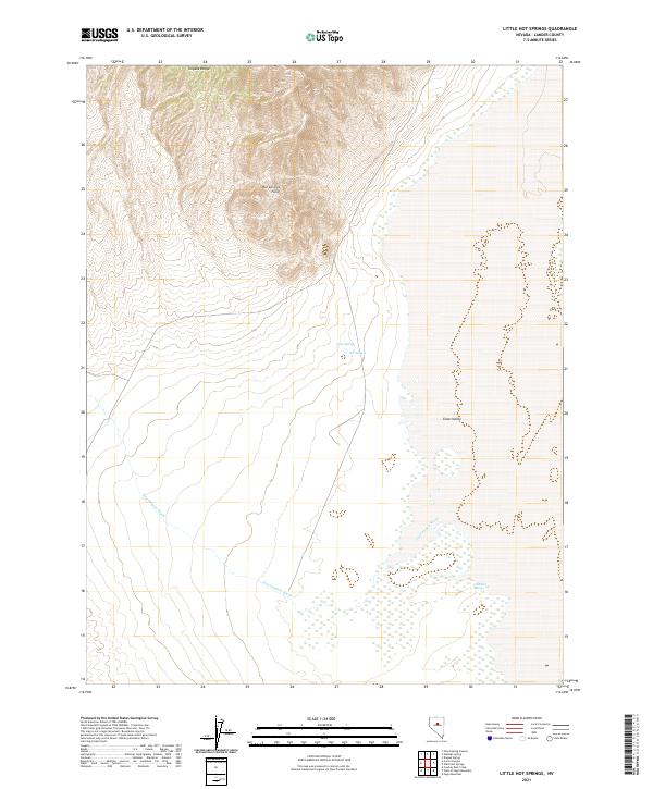
2021 Map of Little Hot Springs
USGS Topo · Published 2021About this map
Toiyabe Range peaks dominate the northern portion of this Nevada landscape, descending sharply toward the level expanse of Grass Valley. This 2021 topographic map illustrates a classic Great Basin environment where high-altitude ridges meet an arid basin floor. The transition is marked by Hot Springs Point, a prominent landform overlooking a series of geothermal and water features including Hot Springs and Crow Spring.
Find a feature on this map
15 named features on this map. Tap any name to fly to it.
Don’t see what you’re looking for? This feature index may not catch every label — zoom into the map to look around manually.
Map Details
Editions of this 2021 Little Hot Springs Map
This is the sole edition of this map. No revisions or reprints were ever made.
Other maps of this area

1926 · Roberts Mountains
USGS Topo · 1:250,000

1929 · Roberts Mountains
USGS Topo · 1:250,000

1938 · Cortez
USGS Topo · 1:48,000

1944 · Cortez
USGS Topo · 1:62,500

1955 · Millett
USGS Topo · 1:250,000

1955 · Winnemucca
USGS Topo · 1:250,000

1956 · Walti Hot Springs
USGS Topo · 1:62,500

1956 · Hall Creek
USGS Topo · 1:62,500

1958 · Winnemucca
USGS Topo · 1:250,000

1959 · Millett
USGS Topo · 1:250,000