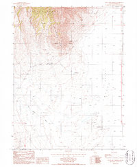
1986 Map of Little Hot Springs
USGS Topo · Published 1986About this map
Hot Springs Point dominates the central landscape of this Nevada survey, serving as a high-elevation divide between the eastern Alkali Flat and the expansive Grass Valley to the south. The area’s mineral potential is evidenced by several prospects and the named Blue Goose Mine located on the steep eastern slopes of the Toiyabe Range. This mid-1980s topography documents a landscape defined by its thermal features, notably Hot Springs and the eponymous Little Hot Springs near a Stock Tank. The presence of multiple labeled fords crossing the drainage of Dry Canyon Wash indicates a network of primitive tracks used by ranchers and miners to navigate the arid terrain before modern infrastructure arrived.
Find a feature on this map
13 named features on this map. Tap any name to fly to it.
Don’t see what you’re looking for? This feature index may not catch every label — zoom into the map to look around manually.
Map Details
Editions of this 1986 Little Hot Springs Map
This is the sole edition of this map. No revisions or reprints were ever made.
Other maps of this area

1926 · Roberts Mountains
USGS Topo · 1:250,000

1929 · Roberts Mountains
USGS Topo · 1:250,000

1938 · Cortez
USGS Topo · 1:48,000

1944 · Cortez
USGS Topo · 1:62,500

1955 · Millett
USGS Topo · 1:250,000

1955 · Winnemucca
USGS Topo · 1:250,000

1956 · Walti Hot Springs
USGS Topo · 1:62,500

1956 · Hall Creek
USGS Topo · 1:62,500

1958 · Winnemucca
USGS Topo · 1:250,000

1959 · Millett
USGS Topo · 1:250,000