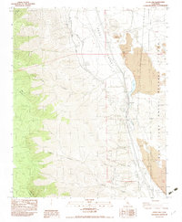
1983 Map of Little Lake
USGS Topo · Published 1983About this map
Rose Valley serves as a corridor for critical regional infrastructure in the early 1980s, dominated by the path of the Los Angeles Aqueduct. This engineering feat is shown in detail as it traverses the valley floor, transitioning between aqueduct masonry covered and underground segments. The volcanic nature of the landscape is evident through features like Cinder Hill and the active Cinder Pits, alongside the natural landmark at Fossil Falls.
Find a feature on this map
26 named features on this map. Tap any name to fly to it.
Don’t see what you’re looking for? This feature index may not catch every label — zoom into the map to look around manually.
Map Details
Editions of this 1983 Little Lake Map
2 editions found
Other maps of this area

1905 · Olancha
USGS Topo · 1:125,000

1906 · Kernville
USGS Topo · 1:125,000

1907 · Olancha
USGS Topo · 1:125,000

1908 · Kernville
USGS Topo · 1:125,000

1908 · Ballarat
USGS Topo · 1:250,000

1913 · Ballarat
USGS Topo · 1:250,000

1915 · Searles Lake
USGS Topo · 1:250,000

1947 · Trona
USGS Topo · 1:250,000

1948 · Trona
USGS Topo · 1:250,000

1948 · Death Valley
USGS Topo · 1:250,000