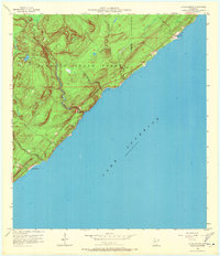
1956 Map of Little Marais
USGS Topo · Published 1971About this map
Lake Superior defines the rugged shoreline of the North Shore, where the settlement of Little Marais sits at the edge of the Finland State Forest. This mid-century survey, published through the cooperation of the State of Minnesota Iron Range Resources and Rehabilitation Commission, documents a landscape shaped by powerful drainage systems. The Manitou River, Little Manitou River, and Caribou River all cut through steep topography to reach the lake, creating dramatic coastal features like Pork Bay and the distinctive Sugar Loaf Cove.
Find a feature on this map
13 named features on this map. Tap any name to fly to it.
Don’t see what you’re looking for? This feature index may not catch every label — zoom into the map to look around manually.
Map Details
Editions of this 1956 Little Marais Map
3 editions found
Other maps of this area

1954 · Two Harbors
USGS Topo · 1:250,000

1955 · Schroeder
USGS Topo · 1:24,000

1955 · Tofte
USGS Topo · 1:62,500

1955 · Cramer
USGS Topo · 1:62,500

1956 · Little Marais
USGS Topo · 1:24,000

1956 · Finland
USGS Topo · 1:24,000

1956 · Finland
USGS Topo · 1:62,500

1956 · Illgen City
USGS Topo · 1:24,000

1957 · Two Harbors
USGS Topo · 1:250,000

1958 · Two Harbors
USGS Topo · 1:250,000